Enlarge image
Zelandicarum insularum exactissima et nova descriptio, auctore D. Iacobo à Daventria

Catalogue information
LastDodo number
5524997
Area
Prints / graphics
Title
Zelandicarum insularum exactissima et nova descriptio, auctore D. Iacobo à Daventria
Artist
Technique
Year
1608
Print run
Signed
Publisher
Dimensions
18,1 x 26,1
Printing office
Theme
Details
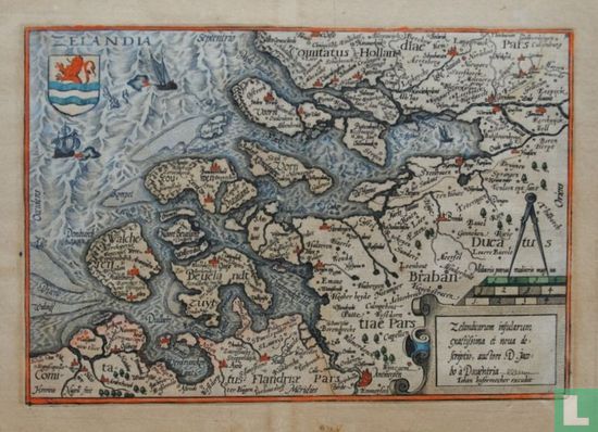
Map of the county of Zeeland with parts of Flanders, Brabant and Holland. Top left the coat of arms of Zeeland. Bottom right the cartouche and scale sticks. Made by Jacob van Deventer (1505-1575). Published in Cologne by Johan Bussemecher in 1608. Source: University of Amsterdam, special collections, 2015.
This text has been translated automatically from Dutch
Click here for the original text
Landkaart van het graafschap Zeeland met delen van Vlaanderen, Brabant en Holland. Linksboven het wapenschild van Zeeland. Rechtsonder de cartouche en schaalstokken. Vervaardigd door Jacob van Deventer (1505-1575). Uitgegeven te Keulen door Johan Bussemecher in 1608.
Bron: Universiteit van Amsterdam, bijzondere collecties, 2015.