
Catalogue information
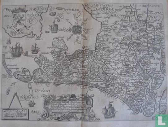
East-oriented map of the county of Holland, with parts of Utrecht and Gelderland. The title at the bottom in a very nice cartouche, with double signature "A. 1539" and "d: ISaenredam" below. Below left the scale sticks in simple cartouche, with a compass above. The sea filled with various ships. At the top in the middle of the Zuiderzee a beautiful compass rose with wind directions written out in full. Top left the coat of arms of the County of Holland, with clearly visible the break in the plate that occurred. In later editions this top corner is missing. See more in detail figure 10. The map covers a large area from the South Holland islands, to the Wadden, to Friesland and parts of Gelderland. Important places on the map include: Hoorn, Alkmaar, Enkhuizen, Haarlem, Amsterdam, Leiden, Delft, The Hague, Wassenaar, Schiedam, Rotterdam, Dordrecht, Utrecht, Amersfoort, Wageningen, etc.
This text has been translated automatically from Dutch
Click here for the original text