
Enlarge image
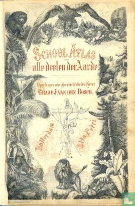
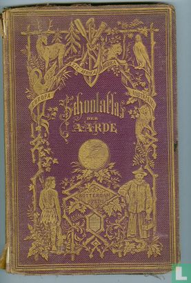
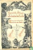
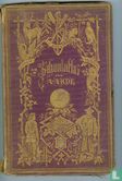
School atlas van alle deelen der aarde


Catalogue information
LastDodo number
2133815
Area
Books
Title
School atlas van alle deelen der aarde
subtitle
Author
Literary collection
Literary number
Addition to number
Publisher
Series / hero
Original title
Translator
Illustrator
Year
1870
Type
Print Run
First edition
Type of book
Number of pages
Number produced
Dimensions
x cm
ISBN10
ISBN13
Barcode / EAN / UPC
Language / dialect
Country of publication
Details
An entirely lithographic school atlas dedicated to Count J. van den Bosch (apparently the third generation to appear in the dedications of the Baedeker and Petri atlases). It includes maps of the world, the continents, the various parts of Europe, the United States of America, the Dutch East Indies, Java, Australia & New Zealand, and Palestine. It was probably sold coloured by the publisher, for some of the maps have printed colour keys, filled in by hand. Two maps name their lithographer (D. Heyse in the Hague). The firm was established by Baedeker, publishing the first edition of the present school atlas (with 22 maps) in 1840, and Petri took it over ca. 1850. Nearly all the maps still bear Baedeker"s name, but followed by Petri's in parentheses. Six maps note they were revised by L.J.C. Ludolph. Koeman gives the atlas a "probable date" 1870, but the maps reflect a slightly earlier situation and Koeman's supplement dates a version with 5 more maps revised 1870. The map of the United States (which does not indicate that it was revised by Ludolph) shows the country between the admission to the union of the states Kansas (1861) and West Virginia (1863), and even the map of North America (which is revised by Ludolph) still shows Alaska as "Russisch Amerika" (Russian America), not reflecting its purchase in 1868. It of course does not yet reflect Stanley's 1870s exploration of the Congo.