Enlarge image
Germania Ptolemaei

Catalogue information
LastDodo number
3833311
Area
Maps and globes
Title
Germania Ptolemaei
Type
Manufacturer / publisher
Country of publication
Cartographer / designer
Year
1720
Print Run
Collection / set
Number in collection
Addition to number
Scale
Continent
Country
Not independent areas
Former countries and colonies
Region / province
City
Material
Type of colouring
Language / dialect
Theme
Dimensions
37 X 30 cm (beeld), 42 x 33.5 (papier)
ISBN13
ISBN10
Details
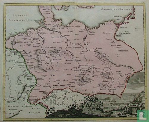
Simple map of the German Empire, bordered by the Rhine. The Zuiderzee is drawn with a wide estuary. The map is embellished with a lavish cartouche of Ptolemy at work with a map next to a globe in a beautifully engraved setting.
This text has been translated automatically from Dutch
Click here for the original text
Eenvoudige kaart van het duitse rijk, met de Rijn als grens. De zuiderzee met een breed estuarium getekend. De kaart is verfraaid met een uitbundige cartouche met Ptolemaeus aan het werk met een kaart naast een globe in een mooi gegraveerde setting.
