Enlarge image
Galliae Veterus Typus

Catalogue information
LastDodo number
3833013
Area
Maps and globes
Title
Galliae Veterus Typus
Type
Manufacturer / publisher
Country of publication
Cartographer / designer
Year
1690
Print Run
Collection / set
Number in collection
Addition to number
Scale
Continent
Country
Not independent areas
Former countries and colonies
Region / province
City
Material
Type of colouring
Language / dialect
Theme
Dimensions
39 x 48.5 (beeld), 54 x 67 papier
ISBN13
ISBN10
Details
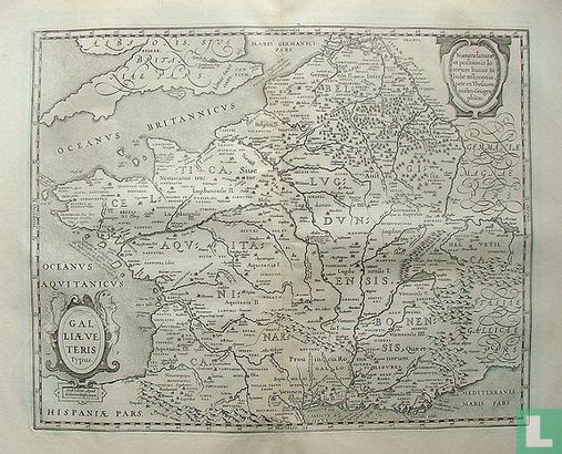
Nice map of France with Latin text in the map. Castles and churches to indicate settlements and mountains and forests have been drawn. Two text cartouches.
This text has been translated automatically from Dutch
Click here for the original text
Mooie kaart van Frankrijk met latijnse tekst in de kaart. Kastelen en kerken als aanduiding van nederzettingen en bergen en bossen zijn ingetekend.
Twee tekst cartouches.
