Enlarge image
Plan de la Ville de Mont-Medi

Catalogue information
LastDodo number
5025705
Area
Prints / graphics
Title
Plan de la Ville de Mont-Medi
Artist
Technique
Year
Print run
Signed
Publisher
Dimensions
14,1 x 18,3
Printing office
Theme
Details
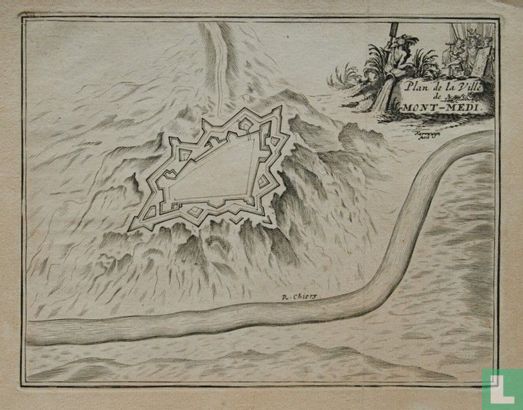
Copper engraving depicting a city map of the citadel of Montmédy-Haut (France), on the river Chiers, with title inside decorated cartouche at the top right. Made by Jacobus Harrewijn (c. 1660 - c. 1740). Presumably published in 'Les délices des Pays-Bas', ca.1710.
This text has been translated automatically from Dutch
Click here for the original text
Kopergravure met voorstelling van een stadsplattegrond van de citadel van Montmédy-Haut (Frankrijk), aan het riviertje de Chiers, met titel rechtsboven binnen gedecoreerde cartouche. Vervaardigd door Jacobus Harrewijn (ca. 1660 - ca. 1740). Vermoedelijk uitgegeven in 'Les délices des Pays-Bas', ca. 1710.