
Catalogue information
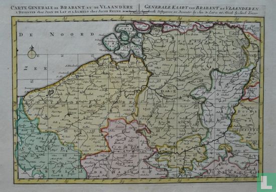
Overview map of the County of Flanders and the Duchy of Brabant, with surrounding areas. The map also shows parts of Northern France, Luxembourg, Limburg and Zeeland. The map was part of an atlas and served as a map pointer for the other maps of the atlas. Graduation in the edge. Top left French title, top middle scale, top right Dutch title, top middle compass rose. Published in Deventer by Jan de Lat and in Almelo by Jacob Keizer, c. 1740. The map covers the area of Lille, Dunkirk, Ostend, Vlissingen, Middelburg, Breda, 's-Hertogenbosch, Tilburg, Eindhoven, Roermond, Maastricht, Brussels, Antwerp, Ypres, Mechelen, Ghent and Bruges. Source: Collection of maps and drawings of the State Archives in Noord-Brabant, at: www.archieven.nl.
This text has been translated automatically from Dutch
Click here for the original text