Enlarge image
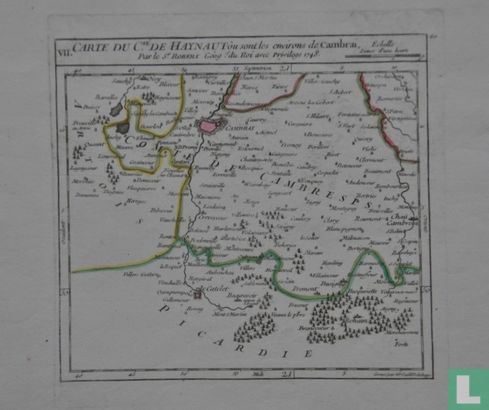
'CARTE DU Cte. DE HAYNAAUT òu sont les environs de Cambrai

Catalogue information
LastDodo number
4879585
Area
Prints / graphics
Title
'CARTE DU Cte. DE HAYNAAUT òu sont les environs de Cambrai
Artist
Technique
Year
Print run
Signed
Publisher
Dimensions
15,8 x 17,1
Printing office
Theme
Details
Map of a part of the county of Hainaut (Hainaut) around Cambrai (Kamerijk). Copper engraving, made by Robert de Vaugondy (1688–1766) in 1748. Presumably published in an atlas around 1760.
This text has been translated automatically from Dutch
Click here for the original text
Kaart van een deel van het graafschap Henegouwen (Hainaut) rondom Cambrai (Kamerijk). Kopergravure, vervaardigd door Robert de Vaugondy (1688–1766) in 1748. Vermoedelijk uitgegeven in een atlas rond 1760.