Enlarge image
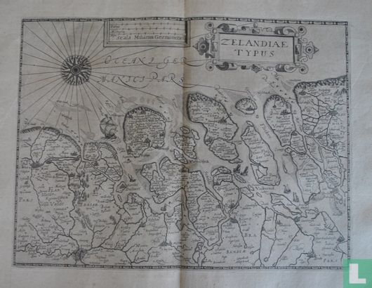
Zelandiae Typus
Catalogue information
LastDodo number
4489683
Area
Prints / graphics
Title
Zelandiae Typus
Artist
Technique
Year
1609
Print run
Signed
Publisher
Dimensions
23,3 x 31,2
Printing office
Theme
Details
West-oriented map of the County of Zeeland, with decorated borders. Above the right of the title in very nice cartouche, to the left of this the scale sticks in simple cartouche. On the left a beautiful compass rose. The sea with various ships. In addition to the current province of Zeeland, the map also includes parts of South Holland, Brabant and Flanders. Important places on the map are: Bruges, Ghent, Hulst, Sluis, Terneuzen, Goes, Vlissingen, Middelburg, Domburg, Bergen op Zoom, Roosendaal, Breda, Zierikzee, Brouwershaven, Brielle, Rotterdam, Vlaardingen, Schiedam, Delft, The Hague, Scheveningen and Dordrecht.
This text has been translated automatically from Dutch
Click here for the original text
West-georiënteerde landkaart van het Graafschap Zeeland, met gedecoreerde randen. Rechts boven de titel in zeer fraaie cartouche, links daarnaast de schaalstokken in eenvoudige cartouche. Links een fraaie windroos.
De zee met diverse schepen.
De kaart omvat naast de huidige provincie Zeeland ook delen van Zuid-Holland, Brabant en Vlaanderen.
Belangrijke plaatsen op de kaart zijn: Brugge, Gent, Hulst, Sluis, Terneuzen, Goes, Vlissingen, Middelburg, Domburg, Bergen op Zoom, Roosendaal, Breda, Zierikzee, Brouwershaven, Brielle, Rotterdam, Vlaardingen, Schiedam, Delft, Den Haag, Scheveningen en Dordrecht.

